Exploring Haida Gwaii by Bike & Kayak

Whenever fall hits I start to get itchy feet. Something about the dropping temperature makes me feel like I need to go on a trip before white fluff falls down and buries the landscape. This year I finally made it somewhere I've been wanting to go for the past couple of years, Haida Gwaii. A lot of people have never heard of this remote archipelago off the northern coast of British Columbia. I'm not sure how I even heard of it but whenever I did, it captured my imagination. Thanks to a blessing in disguise, I had two months off from my job building canoes (probably the most Canadian job you can have, listening to CBC, building canoes at a shop that overlooks a lake) and I went for it with a couple of friends, Matt and Megan.
The plan was to drive 18.5hrs from Fernie to Prince Rupert then take the 7hr ferry with only our bikes to Skidegate. From there we would go to the largest settlement, Queen Charlotte City pop.852, and rent sea kayaks to paddle around for 5 days. Then we would head north along the east coast to do something I've dreamed about doing on Haida Gwaii. Ride the East beach. This is a 90km long beach that covers nearly 1/3 of the entire length of the Haida Gwaii archipelago. After all of that, we would see what we could do with the remainder of our time and play it by ear.

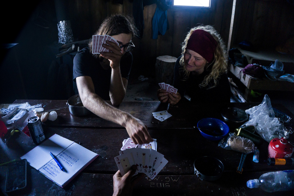
Trying not to forget anything while doing the final pack before we leave the vehicle for the next while.
Now none of us are that experienced when it comes to sea kayaking. Luckily though we are all experienced when it comes to other water-based activities with Matt and Megan working as raft guides, and myself being a whitewater kayaker and canoeist we figured we would be okay as long as we didn't try anything too out there. The one thing that was new to us was having to plan around the tides and this was crucial. If you timed the tides wrong, especially in the channel, it felt like paddling upriver. On the other hand, if you got it right, as we did, we didn't even have to paddle through parts of the channel and instead let the ebbing and flowing current carry us through.

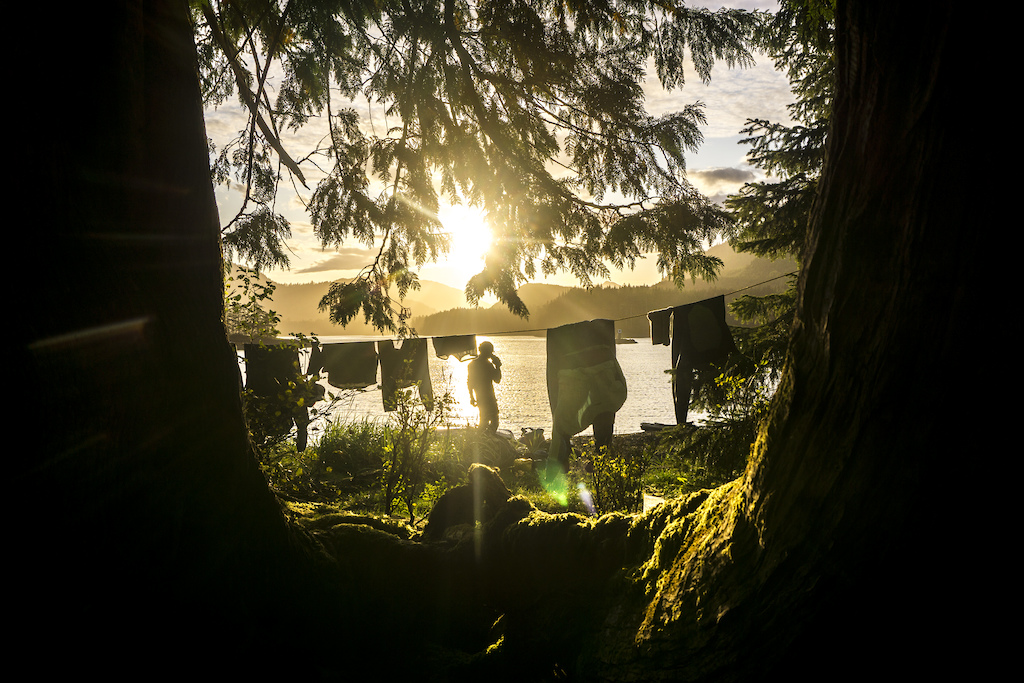
Transforming to kayak mode. Good thing we had lots of dry bags.

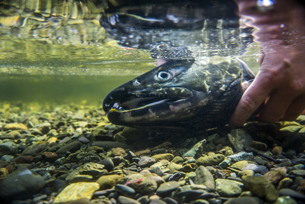
On the second day we saw 5 bears...

... and I can see why. The salmon were just starting to change colour and spawn. This poor guy didn't fare so well.
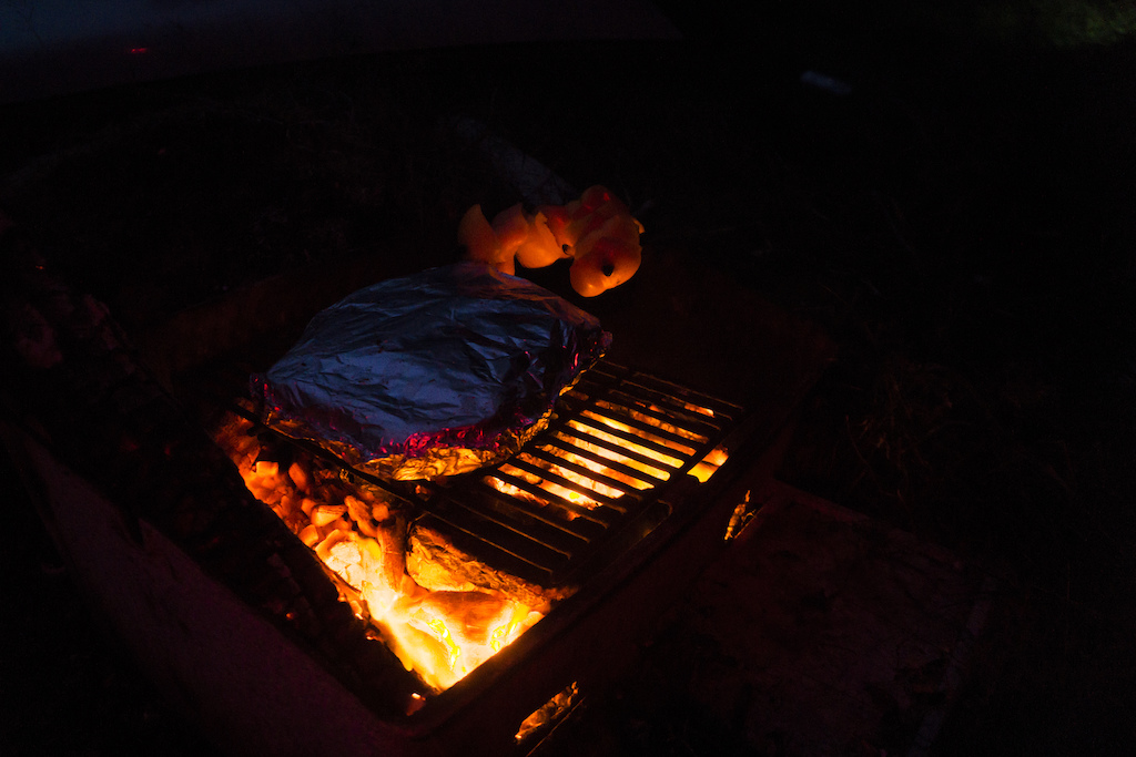
This one didn't do so well either. While spawning salmon generally isn't as good, these ones had only just started and salmon steaks this fresh are still pretty decent.

We were hoping to stay at a cabin marked out on our map as "Zellers" but much like the chain of stores, this cabin was pretty dead. The black mold, mildewy beds, chewed up chairs and dead salmon skin hanging from the ceiling made us opt for our tents instead.

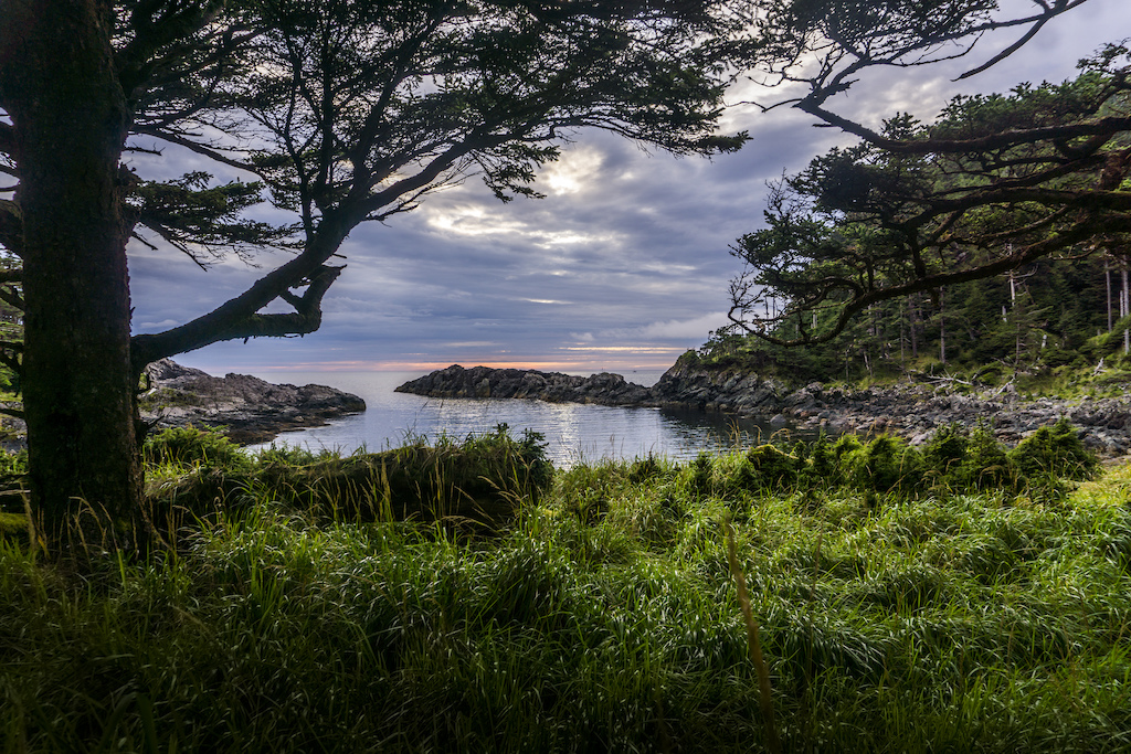
Three days in we finally made it out to the west coast. Most people don't kayak on this side of the archipelago due to it not having many landing points. Luckily we knew we would have good weather for a bit and went for it.
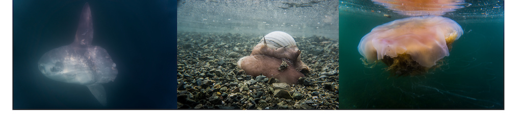
Some of the weird and wonderful animals of Haida Gwaii. Bonus points if you know what the fish on the left is.

Our lunch spot was at the ancient abandoned Haida village of Chaatl. Not much is left but the main attraction here is the Mosquito Pole. This pole used to mark the front of a longhouse and is one of the last standing poles from the 1800s.

This was my favourite campsite of the trip. A tiny inlet on the west coast of Chaatl island nicknamed the "Rubber Room" according to our map.
The secluded cove of the Rubber Room offered amazing views, a creek and ample dry driftwood for our beach bonfire. Also, the wind hammered forest looked like a bunch of bonsai trees.

Our final day proved to be the longest. Luckily though once we rounded the point and headed back east we had a tailwind. We also timed our tides perfectly and while passing through the narrow Skidegate channel we didn't even have to paddle and just let the current take us to camp.
The final kayaking campsite. We lucked out with a nice sunset that helped dry our wet everything.
Finally, after 5 days the kayaking was done. While it was a lot of fun, we were itching to get back on the bikes (literally in my case after wearing my saltwater soaked wetsuit daily for the last few days). Sea kayaking was neat as it allowed us to see a large portion of Haida Gwaii that you can't see by bike. We also got to experience some marine life like the Ocean Sunfish, that fish on the left earlier in the article and heaps of seals and eagles. What I was really missing though was that feeling of coasting downhill. Every time you stop paddling in a kayak you stop moving so it was a nice change of pace to be able to cruise effortlessly again. With the bikes re-loaded we headed north along the beach to where it started in Tlell.
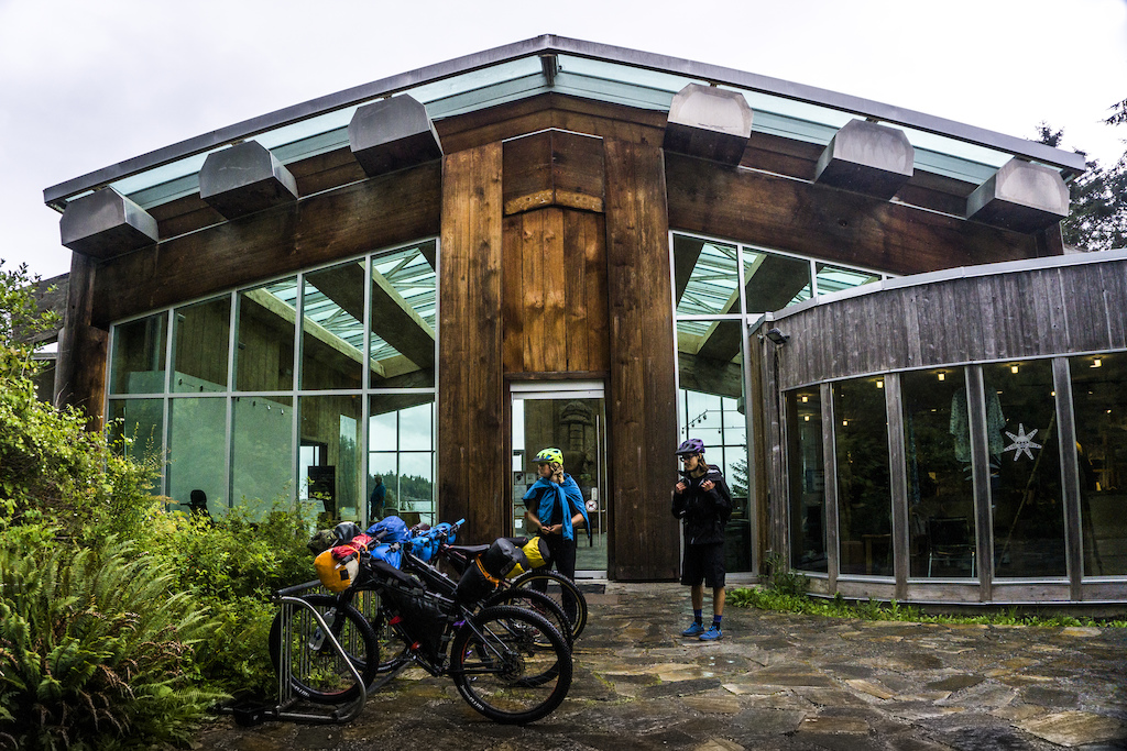
First stop was the museum named Saahlinda Naay, the savings things house.
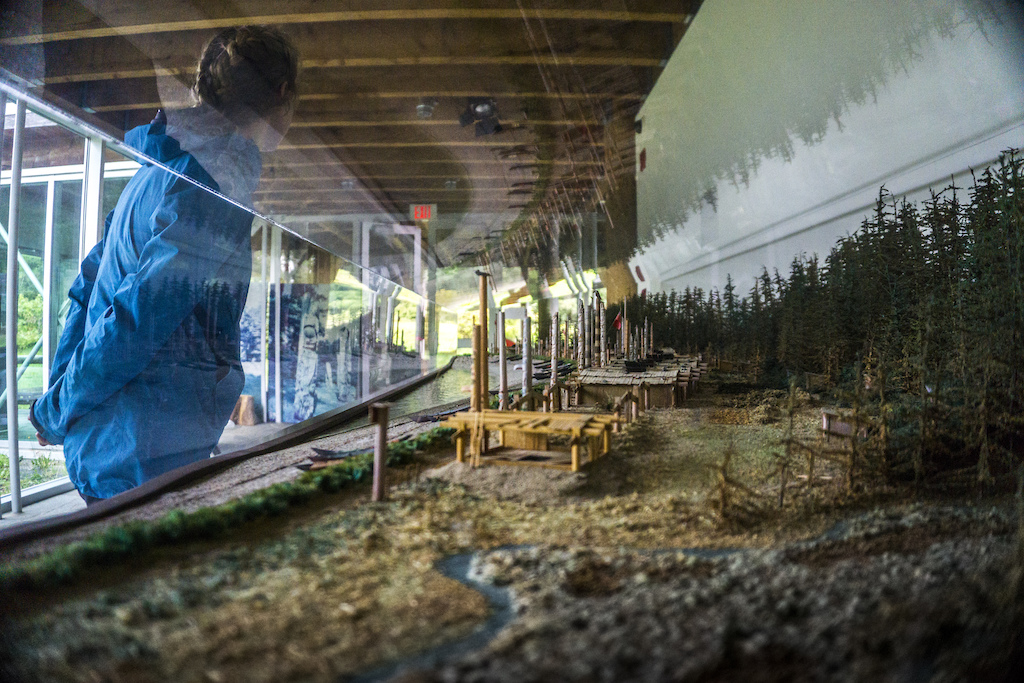
What a Haida village would have originally looked like. There was almost a forest of totem poles. I highly recommend stopping by here if you ever find yourself out here. This was by far one of the best museums I have been to. I was pretty awestruck once I walked into a room that led you towards 4 40 foot ancient totem poles standing in the light. Sadly, there were no photos allowed in the main exhibit.

Canoe and totem pole undergoing restoration.
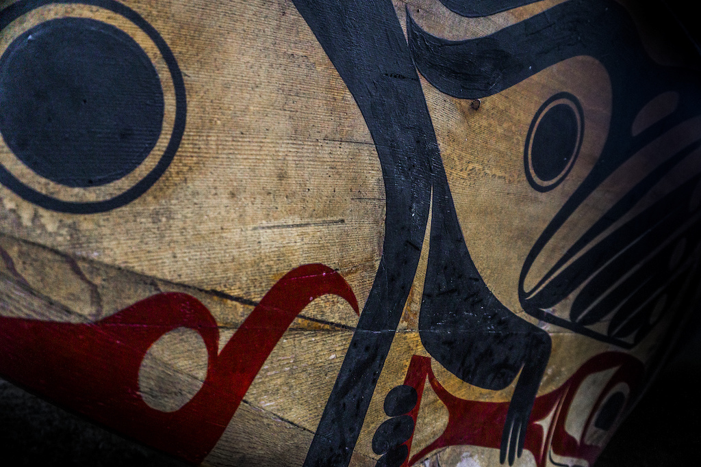
Artwork on the bow of a handmade cedar Haida canoe. These canoes could be in excess of 15m (50 ft).
While we were looking at the model of what the village of Skedans pre-contact a Haida man approached us and showed us this canoe. As it turns out he was part of a crew that paddled this boat from Haida Gwaii to the Aleutian Islands in Alaska. They also made the crossing from mainland BC back to Haida Gwaii which took them around 18hrs to do retracing the routes the Haida people paddled for literally millennia. This was the first time a Haida canoe had landed on the shores of Haida Gwaii since the residential schools and attempts at assimilation started. I noticed the immense sense of pride that the Haida people had of their culture. In every town, we saw people with Haida Nation hoodies, shirts and tattoos. We hears stories about how now that the residential school system has been shut down and funding has been made available for reconciliation their culture is coming back. The man who told us stories about the canoe also told us about how his son can speak more Haida than him and can't stop dancing the traditional dances while when he was younger wasn't allowed to practice either of those things. Later while passing through the village of Skedans we even saw a Haida language school and noticed that a lot of signs in the village were bilingual Haida and English.
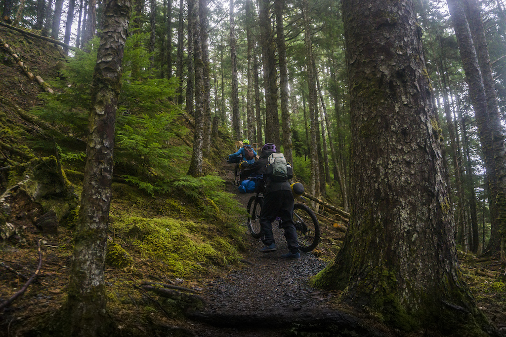

Some balancing acts next to the balancing rock en route to the beach and the push uphill to the Pesuta Shipwreck trail.
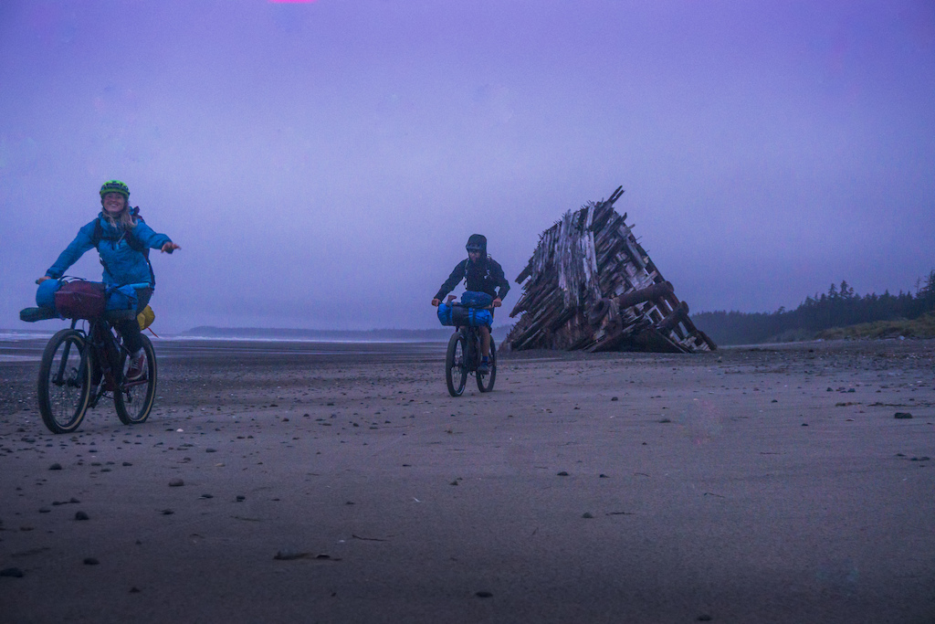
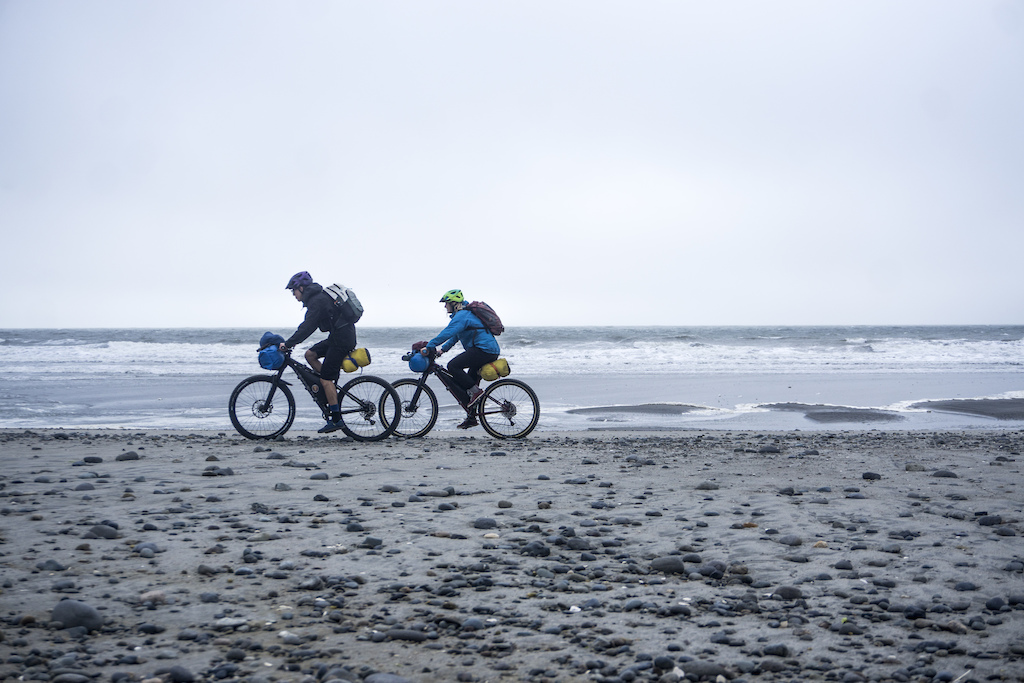
The sun had set but we were beyond stoked that we were able to ride on the beach because up until this point we didn't know if it would work. In my research, before doing this ride I had only ever seen fat bikes on it. It turns out all you need is a 2.3 High Roller with 20psi and we coasted by the wreck of the Pesuta. A 260+ foot barge that ran aground in 1928.
It was now headlamp worthy dark but we arrived at the Cape Ball Shelter.

We were happy we didn't have to set up our tents in the dark and the wind but instead we were treated to a small log hut with a stove and dirt floor. Well rested we packed up our gear and set out.
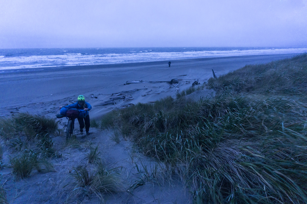
Now while the beach is non-technical riding, you do need to pay attention to the tides. For the first 30km of beach, you follow along the base of a cliff band. If you hit it while the tide is coming in you risk getting trapped.
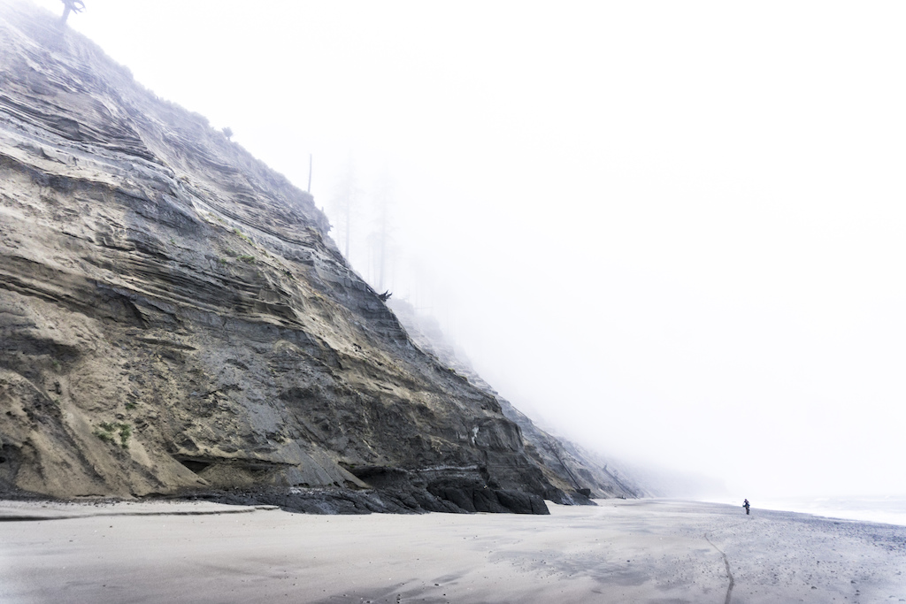
Not kidding about the cliff. I would not want to try and climb this with my bike.
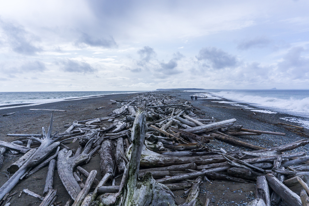
We saw a lot of this over the next 3 days.
Three days later we were finished with the beach. The first day was only a short 16km stretch to the Cape Ball Shelter which also took us by the remains of the Pesuta, a 264-foot barge that ran aground in 1928. Day two we were thankful that we had the shelter to sleep in instead of our tents since we most likely would have been blown down the beach with the strong and nonstop southerly wind. This was going to be what we thought would be the longest day with over 40km of riding to the Cape Fife Shelter. We started out around 9 am after eating oatmeal for however many days in a row and set off.

Currents from Japan carry over a lot of flotsam and jetsam. According to my Google translate app, this is a bottle of some sort of sweet potato alcohol.
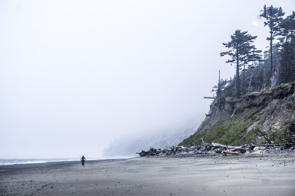
After Cape Ball there is a 30ish kilometer stretch of cliffs that need to be hit on receding tide or you risk getting trapped.
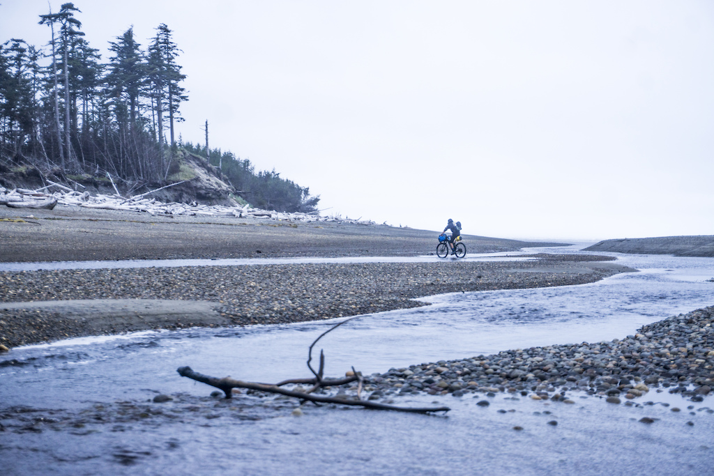
We had plenty of river crossing along the way. This one was one of the bigger ones had had some salmon spawning.
With a strong tailwind Matt and Megan gave sailing an attempt. It didn't quite work.
After a solid day of beach cruising we found the Cape Fife Shelter. This one was luxurious compared to our tents and had two sets of bunk beds, a table, stove and cooking area. In fact, it was so nice we took a rest day and had a crazy rummy marathon tournament.
The second day of riding on the beach was going to be our longest. Not by distance but by time. The plan was to ride up and around the Rose Spit instead of taking the more popular Cape Fife trail. When I was researching the route online it seemed that the Cape Fife Trail could have been a knee-deep mucky bike pushing mud-fest. Riding out to the Rose Spit also looked like it could be quite cool. One of Haida Gwaii's tourism mottos is "Where your world ends, ours begins" and I really understood that while standing at the end of the Rose Spit. Waves crashing over the narrow tooth of sand that protrudes from the end of the archipelago with no land in sight afterwards made for a very end of the world vibe. At the spit, we also had a view of the end of our beachfront adventure, Tow Hill.

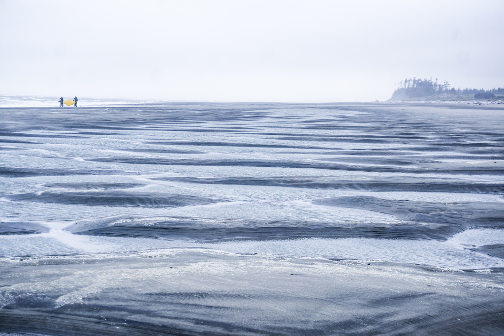
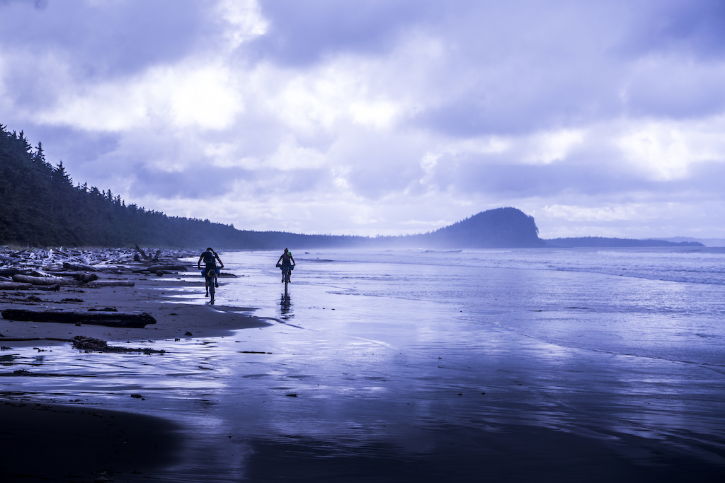
More cruising along the coastal landscape.
The Rose Spit was hard to ride on with it being made out of a lot of loose gravel. You can see Tow Hill, our goal for the day on the right.

There it is, the northern end of Haida Gwaii.
Once we rounded the Rose Spit we had a rough go navigating a sandy maze of almost unrideable roads. Once we hit the beach again it was all worth it again.
The route for the East Beach.
There was a huge sense of accomplishment once we finished the beach. As stunning as riding on the beach was, after 95k of it it felt great to be on dirt and then pavement once again. We camped a night at Tow Hill where we had one of the most incredible sunsets I've ever seen. Once we woke up we made our plan to ride back to Queen Charlotte City. After some discussion, we opted to take a dirt road that runs down the middle of Graham island instead of the highway which we rode part of to get to the beach. Despite some rain and sparse views, it was a real change of landscape, plus we lucked out and got to see how the local salmon hatchery works as well as an ancient unfinished canoe left to rot in the forest.

We needed a spot to camp and stumbled upon this lake along the way. Turned out to be the perfect spot.

Some of the local Haida who manages the hatchery just happened to stop by as we were checking it out. They had 5 big salmon that they came to drop off in the female's pen. After grabbing the fish out of the box of the truck they would run to the dock, drop them in the water, and walk them like a dog along the dock to the pen.
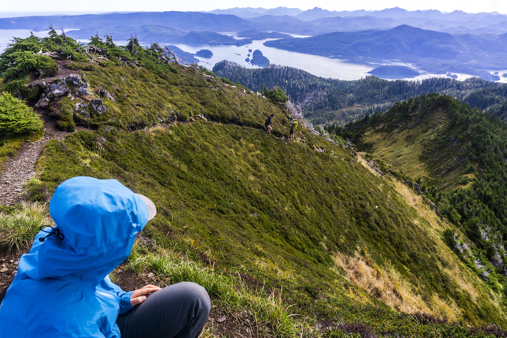
Once we had made it back to civilization we checked out a nearby hiking trail and were treated to some stunning views of the entire archipelago and all the way to the mainland.

The awe-inspiring green of Haida Gwaii's magnificent forests.
After over two weeks on Haida Gwaii, we had seen not even half of what this place has to offer. The landscape here is unlike anything I have seen. From alpine mountains that overlook the densely carpeted swath of islands that dot the ocean to the seemingly endless beach, we followed to the end of the island. The people too are like none other. From the moment we boarded the ferry we had locals telling us stories about the Haida culture and adventures they themselves have had on their land. Those who are lucky enough to live out there are as proud as I have ever seen and we couldn't have been more grateful to get the chance to explore what this place has to offer on Haida Gwaii, translated to "the islands of the people".

Thanks to Rocky Mountain for helping me out and to Sacred ride, Wildways and Ascent Cycle for keeping my bikes rolling.
To find more of my photos and adventure Gravity_Candy.
Author Info:
Must Read This Week
Sign Up for the Pinkbike Newsletter - All the Biggest, Most Interesting Stories in your Inbox
PB Newsletter Signup
One of my favorite books.
www.pinkbike.com/news/the-road-to-haida-gwaii.html